

The Lakes
Big and little Lac Courte Oreilles (LCO) are located near the top of the Couderay River Watershed in Sawyer Co. in northwestern Wisconsin. The name “Lac Courte Oreilles” comes from the French “Lake Short Ears.” Lake Short Ears was the name used by the first French traders who visited what was then known as Ottawa Lake. A local band of Ottawas observed the custom of cutting off a portion of their ears – hence the name. But others suggest the name came from the several ear-like shaped bays on the lake such as Musky and Stuckey bays.
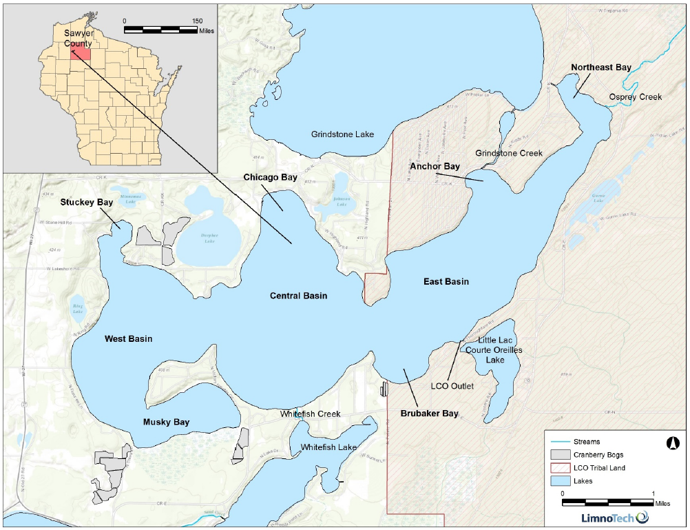
Big LCO covers 5,039 acre and is the 8th largest natural drainage lake in Wisconsin. It has a maximum depth of 95 ft, and averages around 35 ft. Some of the more prominent features are Musky Bay, then Stuckey Bay, the West, Central, and Eastern Basins.
About a third of big LCO and all of little LCO are on the 69,000 ac reservation of the Lac Courte Oreilles Band of the Lake Superior Chippewa.
Big LCO is a very special and sensitive lake. It is classified as an oligotrophic, Outstanding Resource Water. Of Wisconsin’s 15,000 lakes and impoundments, fewer that 1% are designated as Outstanding Resource Waters. This designation is intended to meet federal Clean Water Act obligations requiring Wisconsin to adopt an “antidegradation” policy that is designed to prevent any lowering of water quality – especially in those waters having significant ecological or cultural value. Outstanding Resource Waters are current protected by a specific Wisconsin antidegradation rule (WAC NR 207.03(3)).
Big LCO is a deep stratified, two-story cold-water fishery - one of only five such lakes in Wisconsin with self-sustaining populations of both whitefish and cisco. The State’s most protective total phosphorus criterion, 10 μg/L (NR 102.06), has been applied by WDNR to LCO.
There are ten lakes that comprise the Upper Couderay River watershed. Big and Little LCO are at the base of the drainage, and the outlet from Little Courte Oreilles leads into the Couderay River. The Couderay then joins the Chippewa River, which eventually flows through Eau Claire and into the Mississippi right below Pepin, Wisconsin.
The watershed covers 68,990 ac of which 61% is forested, 12% is agricultural, 9% is developed, 5% is grassland/pasture/shrubland, and the remainder is open water or wetlands.

LCO Buoy Locations
For a digital version of this map click here

Fish Crib Maps and Other Features
For a digital version of this map click here


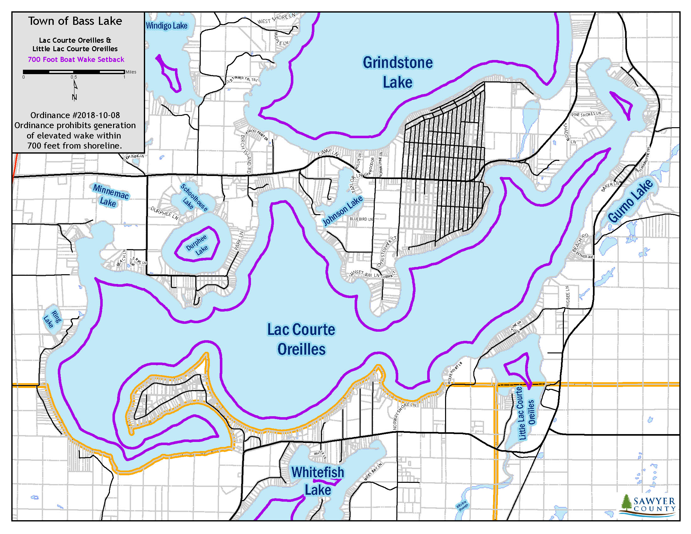
2018 Boat Wake Ordinance
A new boat wake ordinance became effective on November 12, 2018. To view the ordinance click here. The essential elements are as follows:
“No person shall operate a motorboat … on the waters within the Town of Bass Lake, Sawyer County in a manner to enhance an elevated wake for over 50 feet in length closer than 700 feet from any shoreline, dock, pier, raft or other restricted area(s) within the Town of Bass Lake, Sawyer County. An elevated wake is a trail of disturbed water left by the passage of a watercraft in excess of 24 inches. Such prohibited operation shall apply to wake enhancement watercraft by the use of ballast, mechanical hydrofoil(s), uneven loading or operation at transition speed. Transition speed means the speed at which the boat is operating at greater than slow-no-wake speed, but not fast enough so the boat is planning.”
A map of the 700 ft setback boundary is provided here.
LCO Water Level

Click here for an updated graph of LCO water level recorded at the Thoroughfare Bridge.
RELATED STORIES IN SHORT EARS, LONG TALES
Issue 22 'Lac Courte Oreilles Boat Landings'
Issue 25 'Striking a balance: the dam water’s too high, the dam water’s too low'
Issue 34 'Water, and Water Issues, Everywhere'
Issue 54 ‘Water Quality’